 القاهرة - شيراتون المطار - النزهة - رقم بريدى 4471347

 info@geopatra.org

Our tech
Empowering Progress Through Innovation
We rely on cutting-edge tools, software, and engineering solutions to deliver smarter, faster, and more sustainable results. Our technological foundation ensures efficiency, accuracy, and innovation in every project.
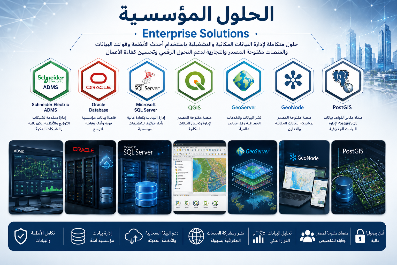
Enterprise Solutions & Advanced Geospatial Data Management
Providing integrated enterprise solutions for managing and analyzing spatial and operational data using advanced systems, enterprise databases, and both open-source and commercial platforms. These solutions support smart network management, enterprise database systems, geospatial service publishing, and advanced GIS platforms to enhance digital transformation, operational efficiency, and decision-making.
- High-performance enterprise database management
- Support for smart networks and advanced ADMS systems
- Publishing geospatial services and web maps
- Integration of spatial data with operational systems
- Powerful open-source and commercial solutions
- Enhanced performance and big data analysis
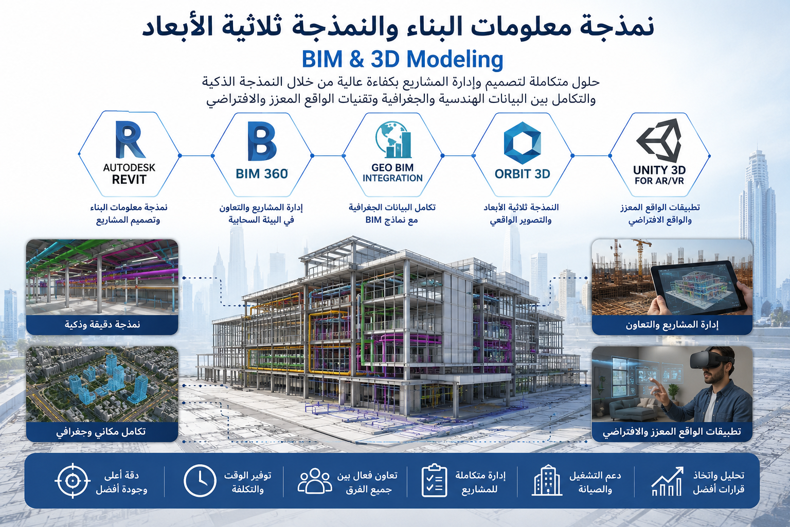
BIM & 3D Modeling Solutions
Providing advanced BIM and 3D modeling solutions using modern digital technologies and platforms for infrastructure and smart city development. The solutions include accurate engineering modeling, integration between geospatial data and BIM environments, and the creation of interactive 3D experiences that support planning, analysis, and efficient project management.
- Creating accurate BIM models for buildings and infrastructure
- Developing high-quality interactive 3D environments
- Integrating GIS systems with BIM models
- Enhancing coordination between design and construction teams
- Supporting project collaboration through BIM 360
- Building AR and VR applications for immersive experiences
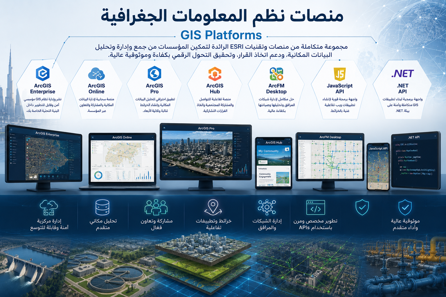
Enterprise GIS Platforms & Spatial Data Management Solutions
Providing integrated Geographic Information Systems (GIS) solutions using advanced ESRI technologies and platforms to develop, manage, and analyze spatial data. These solutions support digital transformation initiatives, improve operational efficiency, and enhance decision-making for government and private sector organizations. Services include geoportal development, asset and network management, spatial analysis, and system integration using modern ArcGIS platforms and APIs.
- Centralized management of geospatial and enterprise data
- Development of modern interactive geoportal platforms
- Advanced spatial analysis for better decision-making
- Efficient utility and asset network management
- Seamless integration with external systems and databases
- Support for web and mobile GIS applications
- Creation of interactive dashboards and reports
Our principles
Guiding values that shape our responsibilities

Lorem ut ea voluptat.
Start Now
Let’s Build Your Vision Together
Whether you’re looking for innovative engineering solutions, digital transformation, or GIS expertise, our team is ready to support your goals. Reach out today and let’s build something remarkable.
Get in Touch